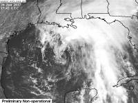
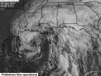
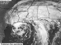
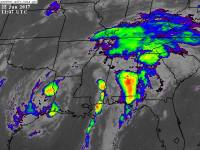
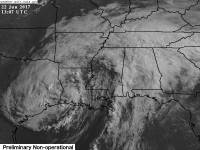
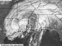
Tropical Storm Cindy
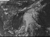 Potential Tropical Cyclone Three formed in the Central Gulf of Mexico at 5 p.m. on June 19, 2017 as the third storm of the year with maximum sustained winds of 40 mph and a central pressure of 1000 mb. The storm was formed with an open left half, having only convection in the Northeast and Southeast Quadrants.
On the afternoon of June 20, 2017, PTC3 was named Tropical Storm Cindy, the third named storm of the year with sustained winds of 45 mph and a central pressure of 999mb. Just before landfall, Cindy had its lowest pressure of 992 mb, and on the morning of June 21, 2017, it had its highest winds of 60 mph. Cindy made landfall early June 22, 2017 as a tropical storm before weakening to a depression by the afternoon.
Cindy remained a depression on land even after landfall, strengthening its winds back up to 35 mph on June 23, 2017, but became a post tropical cyclone later that day. On June 24, 2017, Cindy dissipated over the Mid-Atlantic region of the US into remnants.
Impacts
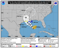 As soon as the NHC issued advisories on the storm, a Tropical storm warning was issued for the Eastern Louisiana coast, and a Tropical storm watch for the Western coast, and for Far Eastern Texas's coast. It is expected to make landfall as a 55mph tropical storm Wednsday, June 21, 2017 in the evening.
Moisture from the system caused heavy rains along the Gulf coast from Pensacola to Louisiana as well as inland Alabama and Georiga, resulting in flooding North of Atlanta on June 20, and along the Gulf Coast on June 21.
Major flooding along the Gulf coast occurred as a result of the heavy rains, with areas receiving anywhere from 2 inches up to a foot of rain.
Sever weather was also an issue. On June 22, 2017, Birmingham area received several tornado warnings, but one tornado, which was conformed an EF-2. Other warnings were issued across Northern Georgia, but none produced tornadoes.
Cindy killed two people, one a 10 year old by when he was struck by a log while walking on the beach with is family, and a man who died on a Texas beach.
Which Model Won?
- ECMWF - supported a solution that kept the storm weak early on and took it across the Yucatan Peninsula into the lower Gulf, then into Mexico. It corrected itself to Texas around Houston the day the system formed with a hard right hook towards North Georgia and Southeast Tennessee. Still kept it relatively weak.
- CMC - supported the system moving into the Florida Panhandle, but shifted west each run two days before formation to Texas/Louisiana area, then a hard right hook towards Georgia and South Carolina.
- GFS - supported a path into Florida like the CMC did, before slowly shifting to Louisiana a couple of days before the storm formed.
- GFS-PARA - Supported the same path as the GFS did, but slightly stronger.
- NAVGEM - supported what the other models supported first. Started by taking the system the way the CMC did, then shifted west with the ECMWF before shifting to Louisiana a few runs before the CMC and GFS did.
- NAM - supported a Louisiana / Texas path towards Houston mainly, but runs varied between strong hurricane and strong tropical storm.
- UKMET - seemed to follow the ECMWF, but ended up with a Texas/Louisiana solution before the ECMWF.
- HWRF - Kept a weak system through the entire run and sent it into Louisiana or Texas the day the storm formed.
- GFDL - Kept a decent system through the entire run and sent it into Louisiana day the storm formed, but strengthened on land.
End Result:
- Long range : CMC and GFS - The CMC and GFS found the storm well out into their runs, even towards the ends of their runs, while the ECMWF didn't pick up on it until it was close to forming. The ECMWF kept the storm south and into Mexico, while the GFS and CMC took it into Mobile, Alabama area. This was closer than what the ECMWF was showing since the ECMWF has a left turn versus a right one. Ultimately, all the models settled on a Louisiana/Texas border landfall before it made landfall there.
- Short range - HWRF and GFDL - These models run for tropical storms, and specialize in tropical cyclones. These two right away went towards the Euro, but rather were further North. They quickly went for Louisiana most runs after that, beating the NAM obviously since the NAM is a Mesoscale model. The NAM was close on location however, but was still a good 50 - 100 miles off.
- Strength : CMC - Sounds odd, but the CMC got the max strength closer than the GFS further out, taking it to around 990mb at its weakest, which was closer than the ECMWF and GFS with pressures staying above 1000mb in the runs.
