Tropical Depression 4
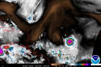
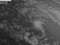
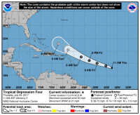
Tropical Depression 4 formed on the night of July 5, 2017 with maximum sustained winds of 30 mph and a minimum pressure of 1009mb, after being monitored by the National Hurricane Center for a few days. The system was expected to stay a depression its entire life.
Impacts
None known.
Which Model Won?
- ECMWF - Early on expected no storm to form, but became aware of a weak system a couple of days before formation. North of the Islands, then into Florida very weak.
- CMC - Developed the system early on and kept its strength, and developed it into a stronger storm later on, pretty much a hurricane or strong tropical storm recurving out to sea.
- GFS - Sniffed out the storm from the end of its runs, but made it a very strong storm either hitting the Eastern Seaboard or recurving. It recurved on more runs than it did hit land. It changed the system to weaker a couple of days before it formed. Weak out to sea, or very weak into Florida.
- GFS-PARA - Maintained the same track as the GFS, but stayed weak most runs except a few which it strengthened into a tropical storm.
- NAVGEM - Weak system the whole time, but took the storm south of the Islands instead of north.
- UKMET - Weak system either south of the Islands or north of them. Changed to strengthen the storm close to Florida, then more in the Gulf after crossing.
- HWRF - Weak system, but relative to what the storm was pressure wise, but making it a minimal tropical storm before formation.
- GFDL - Weak system, practically dissipated.
End Result: Tropical Depression 4 dissipated before impacts occurred to any region, so the ECMWF won since it kept the system relatively weak the entire time while the others blew the storm up. Unless the storm re-intensifies, the ECMWF takes the win. However, for finding the storm far out, the GFS gets a bit of credit for discovery.


