This is an old revision of the document!
Major Hurricane Irma
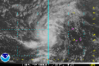
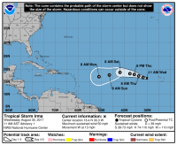
Tropical storm Irma was the first tropical storm to form very close to Cape Verde in the 2017 season. Irma formed as a 50 mph tropical storm with a 1006mb pressure at the first advisory, before jumping to 60mph 6 hours later.
The next day, Irma had strengthened into a strong tropical storm at the 5 AM advisory, with winds of 70 mph. By the next one at 11 AM, Irma had rapidly intensified into a category 2 100 mph 979 mb hurricane due to its small size. Irma jumped up to major hurricane status quickly at the 5 PM advisory the same day with winds of 115 mph and a pressure of 967 mb.
After that, Irma Rapidly intensified into a category 5, and didn't stop there. It went on and became the second strongest storm in history with winds of 185 mph and a pressure of 916 on September 5, 2017.
At the 11 pm advisory on September 11, 2017, Irma became a tropical depression and had its last NHC advisory.
Impacts
Irma made landfall in the Northern Antilles as a major cat 5 with winds of 185 mph and caused hurricane warnings to be issued for the Northern Islands and every Island in its path.
…IRMA MAKES LANDFALL AT CUDJOE KEY IN LOWER FLORIDA KEYS…
The center of Hurricane Irma made landfall at Cudjoe Key in the lower Florida Keys at 9:10 am EDT. A gust to 106 mph (171 km/h) was just reported at the National Key Deer Refuge in Big Pine Key.
New ..CENTER OF HURRICANE IRMA MAKES LANDFALL AT MARCO ISLAND…
The center of Hurricane Irma made landfall in Marco Island in southwest Florida at 3:35 pm EDT as a Category 3 hurricane. A 130 mph wind gust was recently reported by the Marco Island Police Department.
Which Model Won?
- ECMWF - Powerful Category 3 to 5 just north of Greater Antilles, possibly into Florida. As of September 3, 2017: Modeled somewhere between OTS and NC, ensembles OTS to Gulf.
- CMC - Strong cat 2 or 3 hurricane just north of the Greater Antilles. As of September 3, 2017: Into the Mid Atlantic or NC. Strong hurricane into Miami, then into NC up into the Mid Atlantic.
- GFS - Strong hurricane, possibly cat 4 to 5 but out to sea or close or into the East Coast. As of September 3, 2017: Into NC or the Mid Atlantic, with ensembles into Florida to NE, strong cat 4 or 5. Strong Major hurricane, likely 3 to 5 into Savannah.
- UKMET - Tropical storm to Strong 960mb hurricane over entire first run. As of September 3, 2017: South and right north of the Antilles, as a strong cat 4 or 5. Hits Hilton Head as cat 4 or 5.
- HWRF - Developed the storm into a Cat 3 crossing the Atlantic. As of September 3, 2017: Just north of the Antilles as a cat 4.
- HMON - Developed the storm into a Cat 4 crossing the Atlantic. As of September 3, 2017: Further north than overall guidance, strong cat 4 or 5. Sep 6: Went into Miami, up spine of Florida as a 2 or 3 after a hit as a 5.
End Result:
- Long - medium range :
- Short Range :
- Strength :

