This is an old revision of the document!
Tropical Depression 4
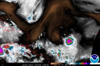
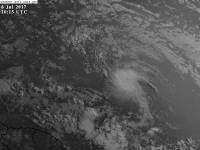
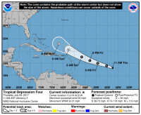
Tropical Depression 4 formed on the night of July 5, 2017 with maximum sustained winds of 30 mph and a minimum pressure of 1009mb, after being monitored by the National Hurricane Center for a few days. The system was expected to stay a depression its entire life.
Impacts
None so far.
Which Model Won?
- ECMWF - Early on expected no storm to form, but became aware of a weak system a couple of days before formation. North of the Islands, then into Florida very weak.
- CMC - Developed the system early on and kept its strength, and developed it into a stronger storm later on, pretty much a hurricane or strong tropical storm recurving out to sea.
- GFS - Sniffed out the storm from the end of its runs, but made it a very strong storm either hitting the Eastern Seaboard or recurving. It recurved on more runs than it did hit land. It changed the system to weaker a couple of days before it formed. Weak out to sea, or very weak into Florida.
- GFS-PARA - Maintained the same track as the GFS, but stayed weak most runs except a few which it strengthened into a tropical storm.
- NAVGEM - Weak system the whole time, but took the storm south of the Islands instead of north.
- UKMET - Weak system either south of the Islands or north of them.
- HWRF - Weak system, but relative to what the storm was pressure wise, but making it a minimal tropical storm before formation.
- GFDL - Weak system, practically dissipated.


